
THE STONE AT KINTRAW – THE FAIRY HILL
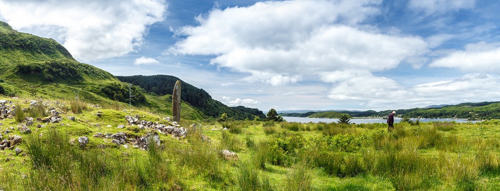
The prehistoric landscape here includes a large cairn (badly robbed of its’ stones), a kerbed cairn excavated in 1959-60 and shown to contain a cist and a 4m high standing stone. This stone had been leaning and finally fell over in March 1979. An excavation of the socket which the fall of the stone had exposed was carried out, showed that only about one metre of the total length of 5.25 metres had been set into the socket, no finds were made during the excavation. The stone was re-erected in its original position, then the base was consolidated with concrete, it will remain for at least another 4,000 years – here’s hoping. The stone is positioned northeast/southwest, estimates of age put the stone about 1800 BC. This area is approx. 6 – 7 miles north of Kilmartin on the road to Oban, it is on a bend and can be seen from the road – no parking here. The stone and cairn can be reached via the bridge at the foot of the hill, then by following a very indistinct path along the north side of the gorge. Do not attempt to cross the gorge directly from the standing stone, as it is dangerous. Kintraw site was an accurate astronomical observatory. Like me, if you want to check this out, please leave your car safely and not in a dangerous location, this road can be hard and dangerous, it is not a broad road. Coming fae Oban it can be seen just after the road (left) to Ardfern – maybe park here and walk.
So the facts and history bits;
A Bronze Age complex consisting of a standing stone and three cairns (four if NM80NW 29 is included). The standing stone measures 13′ in height and 3’6″ in breadth with a thin lozenge section and a rounded top. A horizontal notch is cut in the South edge about 4’6″ from the ground. Cairn ‘A’ lies about 13′ NE of the stone and was excavated by Simpson in 1959 and 1960, after which it was restored to its’ former appearance – an 8′ high stone mound on the perimeter of which a number of kerb-stones were visible, giving a diameter of 48′. A segmented cist (burial), was the only burial found, a few inches within the kerb on the NW. The only finds were six jet beads, apparently unique in their spiral-fluted ornamentation, a medieval bronze buckle, marine shells and animal teeth. None of the finds was necessarily contemporary with the cairn. A date somewhere in the first half of the second millenium BC is suggested, thought to have been originally covered in white quartz. Cairn ‘B’ lies 20′ SW of the standing stone, is 11′ in diameter and 1’6″ high; it was excavated in 1959 and 1960 and restored to its former appearance. It was a low, grass-covered mound which showed slight disturbance in the centre. Excavation revealed, on the W edge of the cairn, a small stone cist, 8″ square internally, built against the inner face of the kerb, one stone of which served as a side slab. Although apparently undisturbed, it contained only a few fragments of carbonised wood. There were no small finds from this cairn. Cairn ‘C’ is a low cairn lying 10′ W of ‘B’. It was not excavated. An early 18th century sketch-plan shows a row of four stones running SW from either cairn ‘B’ or ‘C’, but this is no longer visible. The standing stone is said to have been erected to a Norse prince (Argyll County Council 1914) and is known as the “Danish King’s Grave” as also apparently is cairn ‘A’ .
A settlement at the head of Loch Craignish 10½ miles north of Lochgilphead, Kintraw just south of the Barbeck River which flows into the loch close by. A cairn and standing stone lie immediately to the southeast, while a hill fort is located a short distance to the south southeast and an extensive hill fort on Kintraw Hill, a half-mile to the east. Craignish, Loch – sea-loch on the coast of Argyll and Bute, Loch Craignish lies at the northern end of the Sound of Jura and on the southeastern side of the Craignish Peninsula. Several islands lie within the loch, the largest being Eilean Righ, Eilean Mhic Chrion and Island Macaskin. The village of Ardfern and the hamlets of Corranmore and Kirkton lie on its northwestern shore. Kintraw Hill A summit at the head of Loch Craignish, Kintraw Hill rises to 590 feet a half-mile east southeast of Kintraw. Its flat summit is occupied by a large hill fort, known as Dùn na Ban-Òige. It extends to 656 feet by 558 feet and commands fine views over the surrounding landscape. There are the remains of massive wall to the northeast, which is up to 13 feet in thickness, and once would have surrounded the entire site. IT’S LIVING HISTORY
Surveyed at 1/10,000. Visited by OS (R D) 4 March 1970; RCAHMS 1988, visited July 1980.